Welcome to the Virtual Education Wiki ~ Open Education Wiki
File:France map ULP.JPG
Jump to navigation
Jump to search


Size of this preview: 608 × 600 pixels. Other resolution: 871 × 859 pixels.
Original file (871 × 859 pixels, file size: 130 KB, MIME type: image/jpeg)
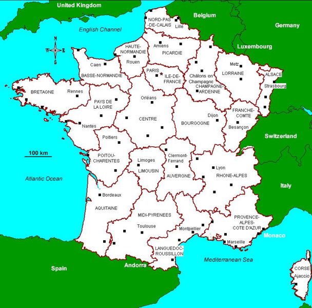
Map of France with the 22 administrative regions (map cf: Eugris)
File history
Click on a date/time to view the file as it appeared at that time.
| Date/Time | Thumbnail | Dimensions | User | Comment | |
|---|---|---|---|---|---|
| current | 08:15, 6 June 2008 | | 871 × 859 (130 KB) | NikkiCortoos (talk | contribs) | Map of France with the 22 administrative regions (map cf: Eugris) |
You cannot overwrite this file.
File usage
The following 2 pages use this file: