Welcome to the Virtual Education Wiki ~ Open Education Wiki
File list
Jump to navigation
Jump to search
This special page shows all uploaded files.
| Date | Name | Thumbnail | Size | User | Description | Versions |
|---|---|---|---|---|---|---|
| 08:43, 30 July 2008 | UNESCO VCO report extract.doc (file) | 59 KB | NikkiCortoos | Towards a Virtual Campus Observatory for Latin America Paul Bacsich, for UNESCO, 2001 (Extract) 1. VIRTUAL UNIVERSITY MODELS 1.1. REASONS FOR SETTING UP A VIRTUAL UNIVERSITY 1.2. DIMENSIONS OF VIRTUALITY 1.3. BUSINESS MODELS 1.4. ORGANISATIONAL MODELS Ty | 1 | |
| 12:00, 24 July 2008 | Distance-E-Learning unis Englisch.pdf (file) | 78 KB | Theo.bastiaens | 1 | ||
| 08:18, 24 July 2008 | Luxemburg.jpg (file) |  |
336 KB | Theo.bastiaens | 1 | |
| 12:11, 23 July 2008 | Au-map.png (file) |  |
15 KB | Theo.bastiaens | Austria map from CIA World Factbook | 1 |
| 09:45, 23 July 2008 | Austrian educational system.gif (file) |  |
20 KB | Theo.bastiaens | Austrian educational system | 1 |
| 08:18, 23 July 2008 | Nl-map.gif (file) | 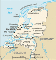 |
22 KB | Theo.bastiaens | 1 | |
| 08:16, 23 July 2008 | Map netherlands.jpg (file) | 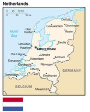 |
55 KB | Theo.bastiaens | 1 | |
| 14:32, 22 July 2008 | 250px-Dutch Education System-en.svg.png (file) |  |
16 KB | Theo.bastiaens | 1 | |
| 09:23, 22 July 2008 | Swissuniversities.pdf (file) | 438 KB | Theo.bastiaens | 1 | ||
| 09:17, 22 July 2008 | Fachhochschulen.pdf (file) | 308 KB | Theo.bastiaens | Size and geographical position of Swiss Universties of Applied Sciences | 1 | |
| 09:14, 22 July 2008 | Swissuniverstities.pdf (file) | 438 KB | Theo.bastiaens | Geographical position and size of the swiss universities | 1 | |
| 12:44, 17 July 2008 | 800px-KARTE schweiz verwaltungsgliederung.png (file) | 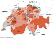 |
227 KB | Theo.bastiaens | 1 | |
| 11:24, 17 July 2008 | Lu-map.gif (file) | 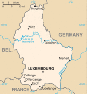 |
10 KB | Theo.bastiaens | 1 | |
| 11:14, 16 July 2008 | Austria-map-cia-wfb.png (file) |  |
11 KB | Theo.bastiaens | 1 | |
| 10:46, 10 July 2008 | 800px-Deutsches Bildungssystem-quer.png (file) |  |
67 KB | Theo.bastiaens | 1 | |
| 07:56, 10 July 2008 | 429px-Map Germany Länder-de.svg.png (file) | 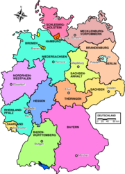 |
121 KB | Theo.bastiaens | 1 | |
| 16:30, 6 June 2008 | UniSofia.gif (file) | 6 KB | Alessandro.Caforio | 1 | ||
| 16:28, 6 June 2008 | Università Telematica Italian University Line.jpg (file) |  |
18 KB | Alessandro.Caforio | 1 | |
| 16:25, 6 June 2008 | Università Telematica Universitas Mercatorum.jpg (file) |  |
50 KB | Alessandro.Caforio | 1 | |
| 16:22, 6 June 2008 | Università telematica internazionale Unitel .gif (file) |  |
6 KB | Alessandro.Caforio | 1 | |
| 16:20, 6 June 2008 | Universita telematica UniSu.jpg (file) |  |
58 KB | Alessandro.Caforio | 1 | |
| 16:19, 6 June 2008 | Università telematica Giustino Fortunato.gif (file) |  |
10 KB | Alessandro.Caforio | 1 | |
| 16:15, 6 June 2008 | Università telematica Leonardo da Vinci.gif (file) | 2 KB | Alessandro.Caforio | 1 | ||
| 16:12, 6 June 2008 | Università telematica Pegaso.jpg (file) |  |
18 KB | Alessandro.Caforio | 1 | |
| 15:48, 6 June 2008 | Università telematica e-Campus.jpg (file) |  |
43 KB | Alessandro.Caforio | 1 | |
| 15:39, 6 June 2008 | Università telematica management audiovisivo TEL.M.A.jpg (file) |  |
39 KB | Alessandro.Caforio | 1 | |
| 11:52, 6 June 2008 | Università telematica Guglielmo Marconi.gif (file) |  |
4 KB | Alessandro.Caforio | 1 | |
| 08:49, 6 June 2008 | Campus numerique PEGASUS.JPG (file) |  |
4 KB | NikkiCortoos | Logo of Campus numérique PEGASUS | 1 |
| 08:44, 6 June 2008 | Cned.JPG (file) |  |
2 KB | NikkiCortoos | Logo for Cned, Centre national d’enseignement à distance (National Centre for Distance Learning) | 1 |
| 08:38, 6 June 2008 | France ULPconsortium UNS.JPG (file) |  |
12 KB | NikkiCortoos | These are the logos involved in the consortium UNIVERSITE NUMERIQUE DE STRASBOURG | 1 |
| 08:15, 6 June 2008 | France map ULP.JPG (file) | 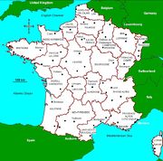 |
130 KB | NikkiCortoos | Map of France with the 22 administrative regions (map cf: Eugris) | 1 |
| 11:35, 5 June 2008 | Koulutusjarjestelma eng.jpg (file) | 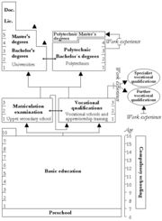 |
63 KB | Urintala | 1 | |
| 11:31, 5 June 2008 | Finnish education.pdf (file) | 176 KB | Urintala | 1 | ||
| 11:14, 5 June 2008 | Fi-map.gif (file) |  |
25 KB | Urintala | 1 | |
| 11:11, 5 June 2008 | EDEN Re.ViCa Paper.pdf (file) | 54 KB | Biekeschreurs | 1 | ||
| 11:07, 5 June 2008 | ReViCa presentation.pdf (file) | 204 KB | Biekeschreurs | 1 | ||
| 11:03, 5 June 2008 | Bacsich-brazil-final.pdf (file) | 39 KB | Biekeschreurs | 1 | ||
| 10:44, 5 June 2008 | Efmd VirtualCampusReality f.pdf (file) | 1,003 KB | Biekeschreurs | Pdf presentation | 1 | |
| 13:17, 4 June 2008 | BM handbook final.pdf (file) | 1.98 MB | IOpdebeeck | 1 | ||
| 10:00, 4 June 2008 | Italy.geohive.gif (file) |  |
30 KB | Alessandro.Caforio | Italy Administrative subdivision | 1 |
| 09:53, 3 June 2008 | Case-studies eleru.pdf (file) | 725 KB | IOpdebeeck | 1 | ||
| 21:34, 2 June 2008 | 15 02 tot.pdf (file) | 257 KB | IOpdebeeck | 1 | ||
| 21:34, 2 June 2008 | Casestudy1.pdf (file) | 304 KB | IOpdebeeck | 1 | ||
| 20:17, 2 June 2008 | UNIQUe info package RH FINAL.pdf (file) | 187 KB | IOpdebeeck | 1 | ||
| 19:56, 2 June 2008 | CEVU manual.pdf (file) | 1.74 MB | IOpdebeeck | 1 | ||
| 19:45, 2 June 2008 | PeerReviewHandbookMASSIVE.pdf (file) | 898 KB | IOpdebeeck | 1 | ||
| 12:44, 5 May 2008 | 268px-Belgium provinces regions striped.png (file) | 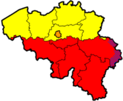 |
20 KB | NikkiCortoos | Map of Belgium showing the provinces (black lines) and regions (colours). Yellow = Flanders, Red = Wallonia, Blue = German-speaking part, Orange = Brussels Capital Region. Original png on: http://en.wikipedia.org/wiki/Image:Belgium_provinces_regions_stri | 1 |
| 12:13, 31 March 2008 | Revica all.jpg (file) |  |
30 KB | Biekeschreurs | 2 | |
| 09:01, 13 March 2008 | EU LifeLongLearning logo.gif (file) |  |
4 KB | NikkiCortoos | 1 | |
| 16:55, 12 March 2008 | Revica.jpg (file) |  |
657 KB | Biekeschreurs | logo s revica | 1 |