Welcome to the Virtual Education Wiki ~ Open Education Wiki
File:New Zealand towns and cities.jpg: Difference between revisions
Jump to navigation
Jump to search
(Topographic map of New Zealand with islands and main population centres labelled This work is in the public domain in the United States because it is a work of the United States Federal Government under the terms of Title 17, Chapter 1, Section 105 of th) |
(No difference)
|
Latest revision as of 16:38, 16 December 2008
Topographic map of New Zealand with islands and main population centres labelled
This work is in the public domain in the United States because it is a work of the United States Federal Government under the terms of Title 17, Chapter 1, Section 105 of the US Code.
File history
Click on a date/time to view the file as it appeared at that time.
| Date/Time | Thumbnail | Dimensions | User | Comment | |
|---|---|---|---|---|---|
| current | 16:38, 16 December 2008 | 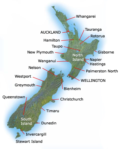 | 480 × 599 (108 KB) | Theo.bastiaens (talk | contribs) | Topographic map of New Zealand with islands and main population centres labelled This work is in the public domain in the United States because it is a work of the United States Federal Government under the terms of Title 17, Chapter 1, Section 105 of th |
You cannot overwrite this file.
File usage
The following page uses this file: